19/3/16
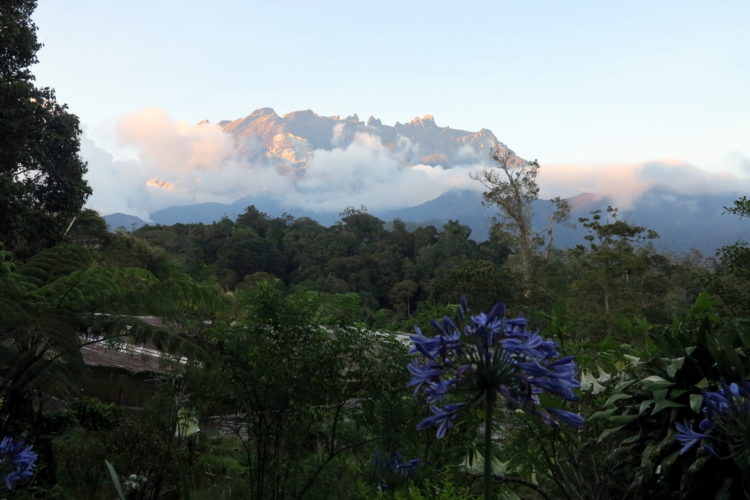
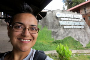
Today I am feeling so frustrated and disappointed. Yesterday, I set out to climb Mt. Kinabalu. Mount Kinabalu is the highest mountain in South East Asia. From the Himalayas in the north to Guinea in the south, there is none to compare with the 4095.2 metre tall (13435 ft.) summit of Low’s Peak here at Kinabalu National Park. It was declared a UNESCO World Heritage site in 2000. Many people come here to Sabah, Borneo to conquer this mountain. Unfortunately, when it came to the battle of Shantha vs. Mountain, Mt. Kinabalu won.
The plan was to hike the first 6 kilometers on the first day. There’s a hostel at that point where people stay the night and then get up at 2am to hike the other 3 kilometers to the summit for the sunrise before descending the mountain. I had heard this mountain was difficult to climb. The people I had spoken with had all said it was very hard. I had even wavered back and forth a bit about whether or not to attempt the climb at all. In the end, I decided to try it, because I was here, and after all, if I didn’t try I’d never know, right? (Now I wonder if ignorance would’ve been bliss!)
I am a slow hiker. I know this. My stride is extremely short, which means I don’t cover a long distance very quickly, and I move pretty slowly as well. I also don’t fare as well on an incline or stairs, particularly as my knees and ankles are poor. Since I used to be 50 kilos (over 100 lbs) heavier than I am now, my joints were ill-used in the past, and never quite recovered. Plus, I’ve had ankle surgery, repeated sprains, and various knee and back issues. Basically, I go nowhere fast. Nonetheless, I enjoy hiking and have had moderate success on hikes, particularly lately, while in Australia.
I know, however, that no group of people would like to hike with me as I would slow them all down, so I decided to book my own guide on this climb. This way, I figured, no one would be waiting for me except for the guy who was paid to do so. I wouldn’t be holding anyone back on the way up the mountain. I am accustomed to being passed up by everyone.
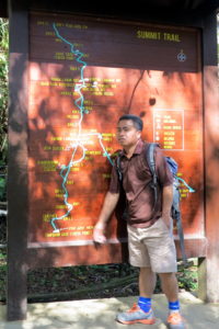
After driving from the park headquarters to the trail entrance, we begain our hike sometime around 9am. Sure enough, within a couple of hours beginning the hike, my guide Joseph and I were at the end of the hikers for the day. (There are only a certain number of passes given out to climb the mountain each day.) I was certain I was the last because two guys in army fatigues, who were the medical team and had clearly been assigned to bring up the rear of the day’s hikers had begun meandering along after me, or waiting at each shelter as my guide and I reached it.
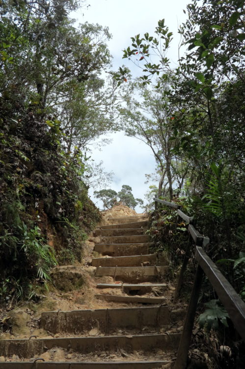
I’d started the hike out at a relatively reasonable pace, but the trail was more or less all steps. There were only a few portions – less than a hundred metres at a time – that were flat, before we’d come to more stairs. The stairs were uneven – either they were stones or wooden beams placed into the side of the hill. The going was rough. After the first couple of kilometers, my pace slowed even further.
I’d had a dizzy spell or two and thought maybe I was dehydrated, so I upped my fluid intake. I thought maybe the two eggs I’d had for breakfast hadn’t been enough, so I had a snack. The dizzy spells weren’t really going away. Finally, I stopped for some lunch, thinking maybe I just hadn’t eaten enough at all. I’ve had so much trouble with the malaria pills I’ve taken that I have not eaten appropriately over the last week at all, so maybe I was just feeling weak. After eating some more protein and some vegetables and even a few carbs, we continued climbing.
The trail was marked every half a kilometer. I was shocked at how slowly those seemed to come! I know I can hike 6 kilometers! I’ve done it before. But 6k straight up? I was beginning to have my doubts. And that would only get me to the hostel. There would still be 3k to go from there. From what I understand, that last 3k is basically all granite. The incline is so steep you have to use a rope to get up. I don’t know that my arms are up to that task, much less my aching legs. That climb would be done in the dark, in order to arrive at the summit for the sunrise. It was sounding less and less appealing the more I contemplated it. By then, I was just hoping I would simply make it to the hostel for the night – forget the summit!
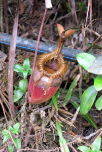
Finally, we had passed the 4k mark. I was happy about that, as I’d been wanting to see a pitcher plant in the wild, and Joseph told me that these only grew above that point. These plants are actually carnivorous and eat insects that fall into them, digesting them in the liquid they have inside their “pitchers.” He even showed me one, shortly after we passed the marker. I had eaten and had been drinking fluids, but my dizziness seemed to be getting worse and I also had a headache. I was seriously concerned that I might not make it. It seemed that the dizziness was getting worse the higher I climbed. Could it be? Was I actually getting altitude sickness? I didn’t really want to believe it. I’ve grown up Colorado, and it didn’t seem possible that it could be true. But then again, I haven’t been home for 2 years, now. I’ve spent most of the intervening time near sea level, and I’d made the ascent to this altitude rather rapidly.
I had a discussion with Joseph, my guide, about what to do. At that point, it was nearly 5pm. We’d been hiking since 9:30am. If I continued up, it seemed I could get worse. We still had almost 2 kilometers to go before stopping for the night. At the rate we were going, it would take over 3 hours to get there. The climb would only get steeper the further we went, apparently. And my headache and dizziness could just increase.
However, if we went back down the mountain, we’d have to walk over 4 kilometers to get back, which would take 4 hours or more to accomplish. Either way, we’d be walking in the dark. I weighed my options. The original direction would be much more difficult, ascending straight up the mountainside. The other direction, I’d have twice as far to go, but might feel better. Though longer, it would be downhill, which would be easier, but difficult on my already protesting knees and thighs. It would also mean I’d have to walk a total of nearly 9k that day, rather than the anticipated 6.
And worst of all, it would mean giving up. I hate making decisions. By then, my head was aching so much, and I was beginning to have difficulty judging where the rocks were as my head was swimming, which made it difficult to know where to put my feet. I was grabbing the rocks ahead of me more and more for balance. Not a good sign. My pace had slowed to a crawl. I wavered between a certainty that I actually had altitude sickness, and a conviction that I was psyching myself out and thinking myself sick as I tried to see if the dizziness was getting worse with the elevation increase.
Finally, I gave in and told Joseph I thought we had better turn around. As we began our descent, my head was stabbing with pain, and I was having trouble with my depth perception as my dizziness came in waves. Nonetheless, I was surprised after a couple of kilometers to notice that my headache had disappeared entirely and that the dizziness was noticeably better. However, it didn’t completely go away, as it might have if I’d just felt better the minute I decided to turn around. I still had issues on the way down, losing my balance a few times and even falling a couple of times. Luckily, as I was going down, I only fell back onto the hill behind me, or slipped a little. I certainly never imagined that I’d be hit with altitude sickness. Who knows, it may have been a combination of the altitude, dehydration, lack of nutrition over the last week or two, any number of things. Regardless…. What a sucky situation.
The sun set after we’d been hiking downhill for a couple of hours. The moon was nearly full, so we had a little light to hike by, but still had to pull out our torches. I’ve always enjoyed hiking at night, although since it’s not super-safe to do without a buddy, I rarely get to do so. Still, although the hike was beautiful, I was definitely a hurting unit! It was difficult picking my way down the mountainside, as nearly every step was a step down a rocky stair step. It was nearly 9pm by the time we reached the gate to the trail.
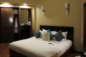
Luckily, Joseph had called ahead and someone was waiting for us with a car to take us back to park headquarters, which was still nearly 5k away from the trailhead. Once there, I was given a hotel room, and a sack dinner. The hotel room was a king-sized room, which was a definite upgrade from the hostel room I’d have had on the mountainside, so that was one plus to the whole mess. I had to wait a while for a shuttle to take me to the building where my room was located (quite a distance from the main park headquarters), but was finally able to settle in and take a shower – yay! I collapsed into bed and slept for hours, thrilled that I wouldn’t have to get up at 2am and hike for 12 kilometers.
In the morning, I got up and walked backto the park headquarters where I checked out the world heritage museum and got some lunch. Then, I left the park and went down the mountain to the hotel where I’d stayed the night before I began my ill-fated trip up the mountain. They’d been holding my bags for me, and I had planned to stay with them for the next night. I was still sore and exhausted, and quite disappointed with myself. Luckily, I no longer felt dizzy or sick, so I guess that was good.
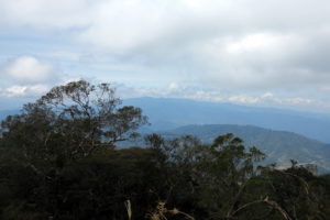
I returned to my hotel, a bit more sore, more disappointed, and more frustrated than I’d been when I left the day before. I had been halfway up Mt. Kinabalu and I’d seen some pretty beautiful sights. Sadly, that hadn’t included the view from the top of Mt. Low. Who knows? Maybe next time….


We’re sorry you didn’t make it to the top, but proud of you for going so far with altitude sickness. One more adventure in your growing list!